I friggin' love maps. Google Maps is like porn to me. How much do you know about St Albert Trail?
I have a friend who lived on Whyte Ave. His directions to his Westlock friend to visit were:
"Go south on Highway 2...when it changes into Whyte Ave, I'm the second apartment on the right ."

As crazy as that sounds, it's perfectly accurate. From way north of St Albert:
Highway 2
St Albert Trail
Mark Messier Trail
St Albert Trail
Groat Road
Whyte Ave
And back then, there was no Mark Messier Trail, so it was easier. His apartment was on 112 St, so it was right near the west end of Whyte. It'd be kind of awesome if he moved northeast of Camrose, because it technically continues:
Sherwood Park Freeway
Wye Road
Township Rd 515
Highway 630
Highway 833
Range Rd 201
"Yeah, just go through a few towns, hamlets, Edmonton...keep following the road...ends at a t-intersection in the country...by a bunch of cows"

Hmmm...I just looked the other way, and Highway 2 goes northwest all the way past High Prairie, then turns into Highway 49...which goes through Spirit River. He married a gal from Spirit River. If her parents were visiting, they'd get instructions like:
"Go east out of town for 550 km...we're the second apartment on the right when you hit Whyte Ave."
or, strangely:
"Go east out of town until you hit Highway 2 the first time, then turn NORTH and follow Highway 2 for 700km...second apartment on the right when you hit Whyte Ave."
But hey, this all started when I was checking out St Albert Trail on Google Maps. Here's a mini-quiz that you'll want to gather all friends and family around for:
Q1) Is St Albert Trail always two-way?
Know-it-alls: Yes, unless you count where Highway 2 splits near Morinville.
True experts: No, part is truly one-way.
Q2) Is St Albert Trail contiguous?
Know-it-alls: No, it's split in two by Mark Messier Trail.
True experts: No, it has four sections.
Q3) This is fascinating - where's everybody going?
It actually ends here at its most southeast point. It's one way...for one block:

That part is at the bottom-right of this map. It goes up until 117 Ave, then continues north from Groat Road at the traffic circle, where everyone knows it.

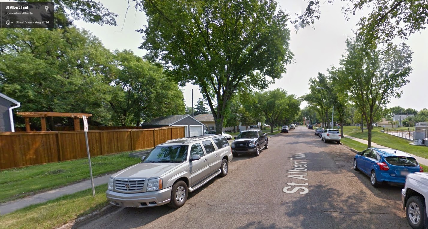
So technically, someone somewhere could say: "Yeah, I live on St Albert Trail. You know that one-block, one-way section? That's the spot. Just park on the road...there's angle parking."
Or: "I live on St Albert Trail. It's nice and quiet for the kids. Narrow, with elms covering the whole thing. Good for road hockey."
[edit] St Albert Trail actually continues on south of 112 Ave around that little loop. Technically, that loop is also a one-way section.
See another blog on this: St Albert Trail


